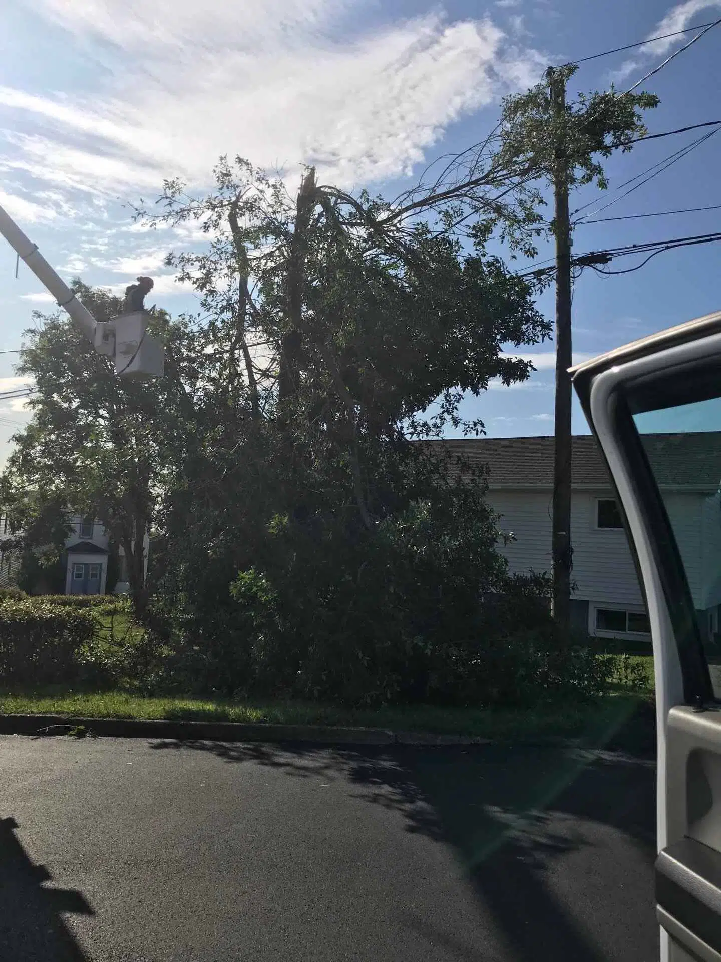
Saint John Energy crews deal with a power outage on Whipple Street on Sept. 8, 2019. (Photo credit: Saint John Energy/Twitter)
The City of Saint John asked residents to stay home and off the roads Saturday evening as the region continues to deal with the effects of post-tropical storm Dorian.
Dozens of roads are closed throughout the city, fire crews are responding to structure fires, and several reports have been received about flooded basements.
Saint John EMO elevated activation to a Level 3 as of 8 p.m. Saturday to allow for enhanced coordination of partner/agency resources and response capabilities.
Trees are down in a number of locations. Pictured here includes Martello Road, Gault Road and Dominion Court. We are also aware of fallen trees on Manawagonish and Westfield Roads. #SJEMO #HurricaneDorian
For your safety, stay clear of these areas and any roads covered in water. pic.twitter.com/pi4HdsC4g8— City of Saint John (@cityofsaintjohn) September 7, 2019
The following roads in Saint John are closed, as of 8:55 p.m. Saturday, due to flooding:
- McAllister Drive at Majors Brook Drive
- McAllister Drive at Westmorland Road
- McAllister Drive at Golden Grove Road
- Westmorland Road between McAllister Place & Parkway Mall
- Rothesay Avenue at Retail Drive
- Rothesay Avenue by Crosby’s is down to one lane each way
The following roads are closed due to obstructions:
- Whipple Street
- Sea Street
- Bayside Drive
- Dominion Court
- Morley Crescent
- St. Coeur Court
- Gault Road
- Martello Road
- Conner Street
- Manawagonish Road – 2 spots
- Lawrence Street
- Crown Street
- Charlotte Street, between Watson Street and Lancaster Street due to safety concerns regarding a large compromised tree
- Paradise Road
- Lancaster Avenue
- Winter Street and Rockland
- Post Office Road
- Lorneville Road
- City Line
- Alexander Street
Officials are asking people to avoid any areas covered in water, downed trees, power and communication lines, poles, or debris. Some signs and barricades are not staying in place due to high winds.
Power Outages
More than 56,000 NB Power customers were without electricity throughout New Brunswick as of 10:40 p.m. Saturday. That was down from 78,000 customers earlier in the evening.
The hardest-hit region is Moncton/Riverview/Dieppe, where more than 21,000 customers were in the dark.
There were also more than 11,000 customers without power in the Shediac/Cap Pele area and 5,600 in the Sackville/Port Elgin area.
More than 6,100 customers were without power in the Kennebecasis Valley/Fundy region, 4,700 in Kings/Queens counties, and 1,100 Charlotte Southwest.
The utility said more than 500 people are supporting their response efforts and crews will continue restoration efforts overnight Saturday. No estimated restoration time is available for most of the outages.
King Square is a mess #HurricaineDorian pic.twitter.com/QEsgdCtsxO
— Jordan McWilliams (@Fundysnapper) September 8, 2019
Meanwhile, Saint John Energy said an estimated 3,000 customers were without power throughout the city as of 10:40 p.m. Saturday.
Spokesperson Jessica DeLong said there is no estimated time of restoration for the outages.
DeLong said they have five Saint John Energy crews plus two E&E Powerline crews working to restore power.
She said crews continue to address safety calls first, such as downed wires and fires.
In Nova Scotia, more than 378,000 customers were without electricity as of 10:40 p.m. Saturday.
Nova Scotia Power said crews continue to stand down until conditions improve for the safety of employees.
Dorian Update
The Canadian Hurricane Centre said the centre of Dorian made landfall southwest of Halifax, N.S., at around 7:15 p.m. Saturday.
The centre of the storm will continue tracking northeastward, passing near Prince Edward Island around midnight, and then over the eastern Gulf of St. Lawrence waters or western Newfoundland by Sunday morning.
Wind gusts up to 140 km/h were reported near Halifax early Saturday afternoon, while the Yarmouth airport reported a wind gust of 130 km/h.
#Dorian made landfall over the Chebucto Peninsula between Terence Bay and Sambro close to 7pm as a strong post-tropical system. Continue to follow https://t.co/4xIIPxgCrs for further updates. pic.twitter.com/2icA12gZgd
— ECCC Canadian Hurricane Centre (@ECCC_CHC) September 7, 2019
Back in New Brunswick, the Saint John Airport reported a wind gust of 95 km/h at 8 p.m. Saturday while the Moncton airport saw a wind gust of 94 km/h at 9 p.m. Saturday.
Forecasters say several reporting stations in western Nova Scotia and southeastern New Brunswick have already received in excess of 100 mm of rain as of early Saturday evening.
Widespread rainfall amounts of 50 to 100 mm are expected over Nova Scotia, Prince Edward Island, and much of southern and southeastern New Brunswick. The maximum amounts are likely over western Nova Scotia, where 100 to 200 mm is possible.
The wind did a number on the Canadian flag at Fire Station #5 at Metcalf & Adelaide in the North end. pic.twitter.com/Xw54CvyzqC
— Tamara Steele (@tamarasteele1) September 7, 2019


